
国務省出版物
米国の地理の概要 – カリフォルニア
カリフォルニアは、全国民の10%以上が居住する州であり、米国文化を織りなす中心的な要素の1つである。国内で生まれた米国人の3分の2以上は、自分が生まれた州に住んでいるが、カリフォルニア居住者のうち地元生まれは半数に満たない。むしろカリフォルニアは、1850年以降、10年ごとに見ても、米国内の移住者の重要な目的地となっている。
地域の定義に用いられる基準の多くに照らすと、カリフォルニアは、地域として単一ではない。例えば南東部のインペリアルバレーの農業人口は、サンフランシスコの都市住民とはまったく異なる。まっ平らなサンワキーンバレーは、険しいシエラネバダ山脈と好対照を成している。南部内陸部には広大な砂漠が広がり、北部沿岸部には樹木が生い茂った斜面がある。米国本土で標高が最も低いデスバレーと最も高いホイットニー山は、互いにほとんど見える距離にある。
カリフォルニアの劇的で多様な自然環境は、州内の定住形態に大きな役割を果たしてきた。険しい地形が広がり、広範囲にわたり水のない土地があるため、それが制約となって、今日、同州の人口の多くは狭い範囲に集中している。実際、米国のアウトドアライフ信仰のメッカであるこの州は、都市化のレベルでは、ほかのどの州よりも進んでいる。その要因はいくつかあるが、自然環境による制約という側面は、間違いなく重要である。
 カリフォルニアの沿岸部は、全体として北西に向かって山脈が長く連なっている。この山々を総称して「コースト山脈(Coast Ranges)」という。その多くは特に標高が高いものではなく、頂上の高さは1,000メートルから1,600メートルである。すぐ西側で地球プレートがぶつかっているため、その圧力によって、山は激しく褶曲して断層が生じている。カリフォルニアの地震断層帯は、コースト山脈と同じく北西に走っている。
この地域の大部分、特にサンフランシスコのベイエリアから南方へ下ってベーカーズフィールド付近までと、ロサンゼルス地区から南東へ向かってインペリアルバレーまでは、小規模な地震がよく発生する。
コースト山脈の東側には、ほぼ全長にわたって、セントラルバレーが横たわっている。この谷底はきわめて平坦で、南北に650キロメートル続いており、幅は場所によって150キロメートル近くに及ぶ。セントラルバレーはもともと太平洋の一部だったが、今では海に面しているのはサンフランシスコ湾だけである。かつて海だったこの場所には、シエラネバダ山脈の西の斜面から浸食物質が運ばれて、多くの堆積物が沈積した。その結果、大規模農業経営にふさわしい、起伏の少ない地形が出来上がった。
セントラルバレーの東側には、激しい浸食を受けたシエラネバダ山脈の緩やかな傾斜が見える。これとは対照的に、山脈の東側は標高が劇的に変化する。シエラネバダ山脈は、巨大な岩の塊が一体となってそびえる断層地塊山脈であり、その東側は西側の斜面よりもかなり急角度で上昇している。標高が高く山道もほとんどないため、シエラネバダ山脈は、カリフォルニア州中部および北部から東の地域へ移動する際の大きな障害となってきた。
セントラルバレーとシエラネバダほどカリフォルニアらしくはないが、あと2つ特徴的な景観を持つ地域を加えれば、カリフォルニア州の地勢図は完成する。北部では、山-谷-山というパターンが崩れ、大部分が山の多い地形になっている。セントラルバレーの真北にあたる中央の高原には、ラッセン山とシャスタ山という、カリフォルニアでも大きな火山が2つある。セントラルバレーの南東側の内陸部には、低い山脈にはさまれて、かなり平坦な土地が広がるグレートベースンがある。
カリフォルニアの気候と植生は、ほとんどその地形と同じくらい変化に富んでいる。降水量に最も大きな影響を及ぼすのは、太平洋北東部から南東に頻繁に移動する湿気の多い空気である。この気団から発生する暴風圏が南へどれだけ移動できるかは、通常メキシコの西海岸沖にある停滞性高気圧の中心によって大きく左右される。この停滞性高気圧が、海洋性気団から発生する暴風圏の南への移動を妨げ、この湿気をもたらす空気を東に進ませて陸地に押し上げる。暴風圏の進路を妨げるこの高気圧は、夏は北へ、冬は南へと漂って行く傾向にある。
この気団の影響を受けて、カリフォルニアの平均年間降水量は、北から南へ向かうにつれて明らかに減少している。平均して北部は南部よりもずっと湿気が多い。さらに、特に南部では、夏は冬よりも乾燥しているのが特徴である。夏の南カリフォルニアでは、雨がまったく降らない期間が長く続くことが多い。その結果、樹木の茂った山の斜面は乾燥してすぐ火がつく。この地域で繰り返し発生する環境問題の1つである森林火災は、長い乾期が終わりを告げる晩夏から秋にかけて最も多く発生する。
サンフランシスコから北の沿岸部は、気温の季節的な変動が比較的少ない。1年を通じて降水量が多く、曇り空の時期が頻繁に訪れる。
セントラルバレーは、カリフォルニアの沿岸部と比べるとかなり乾燥している。年間降水量は、海岸山脈の西側にある同じ緯度の地域の半分にも満たないのが普通だ。例えば、サンフランシスコから北の沿岸部にあるメンドシノの平均年間降水量は920ミリメートルだが、メンドシノからまっすぐ東に向かったサクラメントバレーの中心に位置するユバシティはわずか520ミリメートルである。これより南にある都市を比較すると、沿岸部のサンルイスオビスポの平均降水量は520ミリメートルだが、内陸部のベーカーズフィールドでは年間わずか150ミリメートルの降雨量でやりくりしなければならない。
夏の気温もまた、同じ緯度でも沿岸部と内陸部では大きく異なる。サンルイスオビスポの7月の平均気温は18℃だが、ベーカーズフィールドはこれより12℃近く高い。サンフランシスコでは、晩夏の昼間の最高気温は通常27℃だが、100キロメートル東にあるストックトンでは気温が38℃を超え、焼け付くように暑い。こうした違いの多くは、サンフランシスコの沖合を流れる寒流や、夏の午後と夕方に沿岸部でよく見られる霧が、気候を穏やかにする効果をもたらすためである。
カリフォルニア州南東部のコースト山脈とシエラネバダ山脈の内陸側には、乾燥したステップ(大草原)や砂漠の環境が広がっている。夏の終わりの数カ月間、乾いた風が西の沿岸部に向かって吹くことがあるが、そうすると湿度が極端なまでに下がり、気温は40℃以上にまで上昇することがある。カリフォルニア南東部の内陸では、年間平均降水量が200ミリメートル未満である。
植物相は、場所による気候の違いにぴったり一致している。カリフォルニア南部の低地のほぼ全域と、シエラネバダ-カスケード山脈の東側の地域には、セージ、メキシコハマビシ、チャパラルその他の砂漠や半砂漠地帯に特徴的な植物が茂っている。セントラルバレーと南部海岸山脈の渓谷では、さらに南の地域よりもいくぶん降水量が多いため、ステップ草原地帯になっている。セントラルバレーの周辺と、サンタバーバラからモンテレー湾までの沿岸部に見られるのは、バージニアカシとマツの混交疎林である。モンテレー湾から北の沿岸部は、世界最大の樹木であるアカスギの自生地である。海岸山脈とシエラネバダ山脈の標高が高い場所にはマツとモミの混交林が見られ、シエラネバダ山脈の頂上近くには、セコイアを含む亜高山性のベイツガとモミの森がある。
少なくとも最近まで、カリフォルニア州の最大の欠点は、国内で最も重要な経済の需給地域から3,500キロメートルも離れた、米国の最西端に位置することだった。シエラネバダ山脈から米国の南部と中西部に至るまでの間に、地域内の貨物輸送がほとんどない広大な地域が広がっている。こうした風土が、カリフォルニアの相対的な孤立をさらに深めている。
カリフォルニアの明白な立地上の不利を克服するにあたっては、なによりも気候が重要な役割を果たしてきた。気候は、同州の開拓史にとっても、農業の発展にとっても、ともに重要だった。
カリフォルニアにヨーロッパ人が来る前に住んでいたアメリカ・インディアンは、狩猟と採集で生活していた。食料としては、魚介類や、集めて粉にできる野生の穀物や木の実に依存していた。大きな部族はほとんどなく、たいていは10~20家族の小さな単位でできたグループだった。南北アメリカにヨーロッパ人が最初にやってきた頃には、アメリカ先住民の10人に1人が、後にカリフォルニア州になる場所に住んでいた。
スペイン人の探検隊が1500年代半ばにカリフォルニアのはずれをかすめて通り、ここをスペインの広大な北米所有地の一部であると主張した。だが、彼等はそれから2世紀にわたり、要するにカリフォルニアには注意を払わなかったのである。18世紀末に北米大陸の西側で、英国とロシアの領土拡張に対する懸念が生じて初めて、スペイン人宣教師たちは、サンディエゴからサンフランシスコ近くのソノマまで一連の伝道所を設立したのだった。このような伝道所の設立に加えて、駐屯地(要塞)と少数のプエブロ(集落)も作られた。その後数十年間に、スペイン政府とメキシコ政府は、移民に大規模な土地の所有(大農場)を認めた。それでも、この地域は辺境のままだった。町は小さくて荒廃しており、皮革と獣脂が最も重要な輸出品だった。
1846年に米国がカリフォルニアを併合した後、1848年に中部シエラネバダ山脈の山麓で金が見つかると、この地域の開拓史に最初の大きな変化が訪れた。1年間で4万人もの人々が、サンフランシスコ港を経由し、海路で金鉱地へやって来た。おそらく陸路でも同じぐらいの人々がやって来たと思われる。1850年までに、カリフォルニアは州になっていた。ゴールドラッシュの狂乱は数年しか続かなかった。だが、そのおかげでカリフォルニアは、米国の他の地域から孤立した状況を打破することはできた。
カリフォルニアにおけるスペイン占有の中心であった南カリフォルニアでは、こうした人口増加は起きなかったが、1880年代に西へ向かう鉄道網が完成すると、この地区の平穏な日々は突然終わりを告げた。鉄道需要を掘り起こす活動の一環として、鉄道会社は入植者を広く公募し、新参者たちが家や仕事を見つける支援を行い、運賃を引き下げた。1881年から1887年まで続いた南カリフォルニアの第一次土地ブームの間に、ロサンゼルスの人口は1万人から7万人に増加した。
この時期と、その後の数年間にかけて、ネーブルオレンジ、レモン、バレンシアオレンジ、アボカド、デーツなどの多数の作物も南カリフォルニアに持ち込まれた。これらの作物は東部の市場で需要があった。そして、当時の米国でこれらを大量に供給できるのは、南カリフォルニアだけだった。こうして農業は20世紀初めまで、南カリフォルニア経済の屋台骨としての役割を果たすことになる。
カリフォルニアは、尺度によっては米国で最も都市化が進んだ州だが、同時に、農家の総所得額でみると、最も農業が盛んな州でもある。カリフォルニアで1988年に販売された農産品の市場価格は166億ドルだった。カリフォルニアの農業には、多くの特産物を持つという特徴があるが、気候地域が多様なことや、州人口が多く市場需要があることから、実際には幅広い作物を栽培している。
多くの特産物は気候や土壌の変化に敏感である。太平洋に通じているコースト山脈の盆地は、よく霧が出て気温が温暖である。このような気候条件では、アーティチョーク、レタス、ブロッコリー、芽キャベツなどの野菜がよく育つ。一般に最高のアメリカ・ワインの原料になると考えられている品種もののブドウの栽培には、コースト山脈の盆地の中でも、サンフランシスコ周辺の内陸部でみられる暖かくて晴れた気候が必要である。夏の気温がサンフランシスコよりも高くなるサンワキーンバレーと南カリフォルニアのブドウは、生食用、レーズン、そして、ワイン好きが一流とは見なさないレベルのワイン用に使われる。米国で種子用に栽培される花のほとんどは、サンタバーバラの西にあるロンポクバレーで生産されている。ネーブルオレンジとレモンのほとんどは、沿岸部と、ロサンゼルス盆地を囲む内陸部だけで生産されている。
カリフォルニア特産の多くの農産物の重要性は、同州の農民が遠く離れた東部の市場への進出で大成功を収めたことからも説明できる。これらの作物を栽培できる、少なくとも大規模に栽培できる場所は、米国内でも限られている。そのほとんどが長い栽培期を必要とする。従って、需要の多い地域には、生産競争の相手がいない。南カリフォルニア、特にインペリアルバレーは、競争が最も少なく価格が最も高い冬期にも、野菜を供給することができる。
カリフォルニア州は多くの農産物を生産しているが、それぞれの地域は、1つもしくは少数の作物を専門的に栽培しており、カリフォルニアの特産物の中には、ほんの一握りの農家しか栽培していないものもある。サンワキーンバレーバレーでは、一部の農家が所有する土地面積は数千ヘクタールを超えているところもある。
農業によって、カリフォルニアの大部分の地域では膨大な量の水の需要が生まれた。同州の綿花、テンサイ、野菜、コメ、果物、花、木の実のほとんどは、灌漑農地で栽培されている。ここは米国で最も農地の灌漑が進んだ州である。およそ350万ヘクタールで灌漑が行われ、また、同州の農民は全米で使われる灌漑用水の4分の1以上を使っている。平均すると、カリフォルニアの灌漑農地は年間約1メートルの「人工」用水をもらっていることになる。
どこの場所で何の作物を栽培するかは、利用できる水の量のほか、土壌、排水、地形、耕作期間によって決まる。しかし通常は、灌漑が利用できるかどうかが最も重要な決定要因である。サンワキーンバレーバレー一帯の「トランセクト」(訳注=植生を横切って作った帯状の標本地)の一例をとると、シエラネバダ山麓の丘陵地では家畜の放牧が行われ、その下のより平坦だが灌漑を行うにはまだ標高が高すぎる土地では穀物の乾地農業が行われ、さらに、谷底近くの排水がいい土壌では灌漑を行って果樹やブドウが栽培され、平らな谷底では綿花や野菜などの畑作物が灌漑農法で生産されている--といった具合になる。
カリフォルニア州の降水量のおよそ70%は、農地や都市部がほとんど存在しない北部の山岳地帯や渓谷、シエラネバダ山脈で降る。これに対して、灌漑用水の80%は、降水量の少ない南部で使われる。同州の主要農業地域のうち、平年で500ミリメートル以上の降水量があるのは、サンフランシスコの北側の地域と、南の沿岸部にある少数の渓谷だけである。
農家は水の主な利用者だが、カリフォルニアの大規模な水の輸送施設の開発に着手したのは都市だった。20世紀初め、ロサンゼルスでは人口が急増したため、地元の地下水だけでは供給を賄えなくなり、シエラネバダ山脈の東側にある、ロサンゼルスから北へ約300キロメートル離れたオーウェンズバレーで不足分を補う水源を探した。1913年には、「ロサンゼルス送水路(Los Angeles Aqueduct)」が水をロサンゼルスまで運んでいた。この送水路が提供できるのは、ロサンゼルスの需要の半分である。1928年にロサンゼルスと南カリフォルニアのその他10都市が、自分たちの地域に十分な水を供給するために、「都市圏水供給公社(Metropolitan Water District)」を作った。今日では同公社は、6つの郡と、130以上の都市、そしてカリフォルニア州の総人口の半数に水を供給している。
カリフォルニアの水の歴史でおそらく最も劇的なエピソードは、1905年に起きたインペリアルバレーでの出来事だろう。1901年に複数の民間グループがコロラド川からインペリアルバレーまで水を運ぶ運河を建設した。その後、またたく間に農地ブームが起きた。1905年2月にコロラド川が洪水で氾濫し、灌漑用水路に流れ込んだ。多大な努力を払った結果1906年秋に川を元の水路に戻すことができたが、その前にインペリアルバレーのうち1,100平方キロメートルがソルトン湖の下に沈んでしまった。この湖はまだ残っており、渓谷の灌漑農地から継続的に排水される水によってその大きさを維持している。
1940年代に連邦開拓局(Federal Bureau of Reclamation)が、セントラルバレー灌漑用水の地元での有用性を向上させるために、セントラルバレー・プロジェクトを開始した。今日では、サクラメント川から取られた水が、デルタ・メンドータ運河によって、サンワキーンバレーバレーの西側を通って南のメンドータまで運ばれ、そこでサンウォーキン川に注ぎ込まれる。従って、サンウォーキン川の通常の流れは、そのほとんどを、カリフォルニア随一の農業地帯であるこの盆地の南部の灌漑に使うことができる。
カリフォルニアは農業面で全国的にも重要な州だが、にもかかわらず人口は、圧倒的に都市居住者が多く、さらに増加し続けている。カリフォルニアの人口は、そのほとんどがロサンゼルスとサンフランシスコという2大都市を中心とする都市部に居住している。
1880年代の土地ブームによって、ロサンゼルス盆地と南カリフォルニアの沿岸地帯に散在する何十もの都市が生まれた。人口が増加するにつれて、これらの都市は、かつて各都市を空間的に隔てていた農村地域に延びていった。
サンタバーバラからサンディエゴまでの300キロメートルに及ぶ沿岸線は、約1,500万人が住む1つの細長い巨大都市圏で占められている。この都市集合体は、基本的に20世紀の産物である。従って、19世紀と20世紀初頭に東部の都市が備えた景観的特徴の多くは、ロサンゼルスにはない。同市に欠けている特色とは、例えば、階段で上がる4階または5階建てのアパートや、ほぼ同じ高さの倉庫、高架または地下の鉄道路線などである。
ロサンゼルスという南部の大都市で最も重要な潤滑油は、いまも昔も自家用車である。ロサンゼルスの中心部の優に半分は、道路もしくは駐車場という自動車のための用途に明け渡されている。この都市では高速道路網が密に張り巡らされているため、端から端までかなり速く移動することができる。ロサンゼルス地区の住民1人当たりの車の数は全米一多く、公共の輸送機関は最低限しかない。
最後に、ロサンゼルスは中心を持たない都市である。都市活動の中心となる伝統的な単一の中央商業地区が、ここでは何とか存在する程度である。ロサンゼルスは、実際には多数の都市の複合体であり、その各都市の規模が大きくなるにつれて一緒に成長してきたのである。そのうち14都市の人口は、現在10万人を超えている。有力な中央商業地区がないのは、各都市に独立した中心部が残っていることも一因である。
この地域に資源がないわけではないが、全体的な重要性はそれほど高くない。農業のほかには石油の生産が重要であり、米国の主要油田のうち3つは南カリフォルニアにある。1965年に海底油田の開発が始まった。ガソリンなどの石油製品に対する需要が大きいため、南カリフォルニアで生産された石油製品の事実上すべてが、地元で消費される。
南カリフォルニアは、長らく米映画産業の中心であるハリウッドの所在地として、世界的に有名である。映画製作の初期の時代には、屋外セットと自然光が当たり前だった。この地域は晴れることが多く、気温が低い時期が短いため、地元の道路や野外を使って多数の映画が撮影された。ロサンゼルスは今でも米国の映画とテレビの中心地の1つだが、今日では、映画産業による雇用は地域の労働人口の2%足らずに過ぎず、大都市圏経済への貢献度は低い。
南カリフォルニアは気候に恵まれ、特に沿岸部で変化に富む景色を楽しむことができるため、早くから国内有数の屋外レクリエーションの中心になった。今日では、このような自然の利点を補完する形で、米国で最も先進的な最大規模のレクリエーション施設が発展している。サンディエゴのバルボアパークとその素晴らしい動物園、ナッツベリーファーム、そしてマリンランドが代表的なレクリエーション施設である。ディズニーランドは米国の社会現象の1つとなり、多くの観光客が目指す目的地となっている。
南カリフォルニアは、米国に入国するラテンアメリカやアジアからの移民が目指す目的地の代表格でもある。ロサンゼルス学校区の児童の4人に1人以上が、英語以外の104言語のうちの1つを母語としている。
特に最近の移民は、少数民族地区に落ち着くことが多い。長年ロサンゼルスの一部だったリトルトウキョウには、活気が戻って来ている。サンガブリエルバレーのモンテレーパークは、人口の50%がアジア系で、米国本土で最もアジア色の強い都市になっている。ここには様々な種類のエスニック・レストランがあるが、その多くは、都市部のあちこちにある少数民族の居住地区に存在する。
しかし、これらすべてを総合しても、1,500万人の人々の生活を支える資源としては不足している。石炭や鉄鉱石のような重資源はまったく存在しない。サンディエゴには良質の港があるが、ロサンゼルスの港は完全な人工港であり、質も平均的である。
しかし、南カリフォルニアは、全米のどの地方よりも多くの利益を政府歳出から受けている。国防総省の歳出総額の約20%、米航空宇宙局(NASA)の予算の半分近くを、カリフォルニア州が受け取っている。サンディエゴは米海軍の西海岸における母港で、海軍は間違いなくサンディエゴ最大の雇用者である。サンディエゴは人口が200万人を超える都市だが、その割には製造業の雇用が相対的に少なく、それが米国有数の住みやすい都市といううたい文句の重要な根拠の1つになっている。また同時に、製造による付加価値が高く、労働者の技能が特に重要なエレクトロニクス部門が、南カリフォルニア経済に大きな貢献をしている産業の1つになっている。
ロサンゼルスの小売り売上高はニューヨーク大都市圏よりも多く、ここで生産される製品の価値も高い。10年前にロサンゼルスは、西海岸の金融の中心地としてサンフランシスコを追い抜き、現在は預金残高でニューヨーク市に次いで全米第2位である。ロサンゼルスとロングビーチという一対の港が合わさって、世界で最も成長著しい貨物輸送の中心地を形成している。この2つの港を経由して海上輸送される貨物の輸出入額は、今ではニューヨークおよびニュージャージー港を大きく上回っている。
南部の新興都市の住民と違って、サンフランシスコ市民はこの街を古い国際都市と見なすことを好む。サンフランシスコはカリフォルニアにおけるスペインとメキシコ勢力の、北の中心だった。カリフォルニアのゴールドラッシュでは、補給基地としての役割を果たした。1850年までには太平洋沿岸最大の都市となり、その地位は1920年まで続いた。1969年に最初の大陸横断鉄道が完成すると、人口が多く、良港を持っていたこともあって、サンフランシスコは米国西部の発展の中核になっただけでなく、太平洋諸国との貿易の中心地にもなった。同市にはアジア、特に中国から大勢の移民が流入したのに加え、ほかの外国人も多数やってきた。彼等は無国籍なエスニック文化の混合を生み出し、それがこの都市の一目でわかる特徴として今も残っている。
こうした初期の歴史がもたらすロマンチックで粋な一面は、サンフランシスコが全米有数の人気都市になった数多くの理由のうちの1つに過ぎない。自然地理的条件も、一都市に申し分のない舞台を提供するもので、同市の場合は、急な坂道が続くため太平洋やサンフランシスコ湾の劇的な眺めを一望することができるし、気候が温暖であるため、南カリフォルニアの夏を時々襲う、驚くほどの暑さとも無縁だ、という訳である。
現在サンフランシスコ市の人口は、サンフランシスコ・ベイエリアに住む540万人のうちの8分の1未満である。サンフランシスコ都市圏が全体として成長する中で、小さな半島に押し込められたサンフランシスコ市の人口は、実質的に減少している。
今日のベイエリアは、いくつかの異なる地区から成り立っており、それぞれが特徴を持っている。イーストベイは最も多様な地区であり、学生街、中流階級の人々が住む大きな区域、ここカリフォルニア地域の港湾施設や重工業のほとんどがある区域などが混在している。サンノゼ・サウスベイ地区には中流の上のクラスが住み、新しい住宅、美しい庭、地域の大きなショッピングセンターがある。サンノゼの北のサンフランシスコ湾沿岸には、シリコンバレーがある。シリコンバレーという名前は、コンピューター部品の生産に関係する化学・電子機器の研究に従事する企業が集中していることに由来する。ゴールデンゲート・ブリッジの北側は都市の規模が小さく、製造業もほとんどない。土地の農業利用か都市利用かをめぐる意見の衝突が、時々表面化したりする。ここには、田舎の土地を探す裕福な都会人がいるからである。サンフランシスコ市自体は、斜面の多い地形には不似合いの格子状の街路、隙間なく並んだ19世紀末から20世紀初頭にかけての建物、そして民族的多様性などの、独特の魅力を今も維持しいている。
ロサンゼルスとは異なり、ベイエリアに大きな都市の中枢があることは、驚くに当たらない。良港と過ごしやすい気候は、重要な立地要因である。荷揚げ量で見ると、サンフランシスコは北米の太平洋側で最も重要な港である。鉄道や高速道路による東部とのつながりは、少なくとも、ほかの西海岸の都市と同程度である。「メガロポリス」が米国にとってヨーロッパとの接触の基点であるのと同じように、サンフランシスコはアジアとの重要な接点なのである。
*上記の日本語文書は参考のための仮翻訳で、正文は英文です。
California
(The following article is taken from the U.S. Department of State publication, Outline of American Geography.)
California
By Stephen S. Birdsall and John Florin
California is home to more than 10 percent of all Americans and a central element in the American cultural fabric. Although more than two-thirds of native-born Americans live in their state of birth, fewer than half of all Californians were born in the state. Rather, California has been an important destination for U.S. internal migration in nearly every decade since 1850.
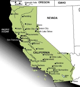
By most of the criteria used in the definition of regions, California (Map 13: 24K) is not a single unit. The agricultural population of the Imperial Valley in the southeast is quite different from the urban population of San Francisco. The striking flatness of the San Joaquin Valley is in sharp contrast to the ruggedness of the Sierra Nevada mountain range. There are broad areas of desert in the southern interior and heavily forested slopes along the coastal north. The lowest and highest elevations in the conterminous United States, Death Valley and Mount Whitney, respectively, are almost within sight of each other.
California's dramatic and varied physical environment has played a strong role in the state's settlement. Most of the state's population today is crowded into a small part of its territory, constricted by expanses of rugged topography and a widespread lack of water. In fact, this mecca for America's worship of the outdoor life surpasses every other state in its level of urbanization. Several factors account for this, but the restrictive aspects of the physical environment are certainly important.
THE PHYSICAL ENVIRONMENT
The coast of California is lined by long mountain ranges that trend in a generally northwesterly direction. They are collectively called the Coast Ranges. Most are not particularly high – summits are between 1,000 and 1,600 meters. They are heavily folded and faulted as a result of the pressures of plate contact just to the west. The California earthquake fault zones follow the same northwesterly trend as the Coast Ranges.
Small earthquakes are common across large sections of the region, especially from the San Francisco Bay area southward to near Bakersfield and from the Los Angeles area southeastward through the Imperial Valley.
To the east of the Coast Ranges for much of their distance lies the Central Valley. This valley is extremely flat, extends 650 kilometers from north to south, and is nearly 150 kilometers wide in places. The Central Valley was originally a massive extension of the Pacific Ocean, open to the sea only at San Francisco Bay. A recipient of the erosion material carried off the western slope of the Sierra Nevada, this former section of the sea has been filled in with sediment. The result is a low-relief landscape rich in potential for large-scale agricultural pursuits.
To the east of the Central Valley, the Sierra Nevada rise gradually and have been heavily eroded. In contrast, the eastern face of the mountains offers a dramatic change in elevation. These are fault-block mountains, large rock masses that rose as a whole unit, and the eastern side was lifted far more sharply than the western face. Because they reach high elevations and contain few passes, the Sierra Nevada have proven a major barrier to movement between middle and northern California and areas to the east.
Two other landscape areas, less identifiably Californian, complete the state's topography. In the north, the mountain-valley-mountain pattern breaks down, and much of the northern tier is generally mountainous. The central plateau portion, directly north of the Central Valley, contains two of the state's major volcanic peaks, Mount Lassen and Mount Shasta. To the southeast of the Central Valley, the Great Basin of the interior is composed of low-lying mountains interspersed with large areas of fairly flat land.
Variations in California's climate and vegetation are nearly as great as the diversity of its topography. Of greatest importance for precipitation is the frequent movement of moisture-laden air southeastward out of the northeast Pacific. The distance southward that storm systems from this air mass can move is influenced substantially by a stable high-pressure center usually found off the west coast of Mexico. Such a stationary center blocks the southward movement of storms emerging from the maritime air mass and forces the moisture-producing system eastward onto shore. This blocking high tends to drift northward during summer and southward during winter.
A definite north-south gradient in average annual precipitation occurs in California as a result of these air masses; the north is much more moist on the average than the south. Furthermore, summers are characteristically drier than winters, especially in the south. In summer, southern California frequently experiences long periods during which there is no rainfall. Consequently, the wooded mountain slopes grow dry as tinder. Forest fires, another of the region's recurring environmental problems, are most frequent in late summer and fall, toward the end of the long dry period.
The coast north of San Francisco has temperatures with relatively little seasonal variation, plentiful year-round precipitation, and frequent periods of overcast skies.
The Central Valley is much drier than the coastal margins of the state. Annual precipitation is usually less than half that found at a similar latitude on the western slopes of the Coast Ranges. For example, Mendocino, on the coast north of San Francisco, averages 92 centimeters of precipitation annually, while Yuba City, directly east of Mendocino in the heart of the Sacramento Valley, averages only 52 centimeters. Southward, coastal San Luis Obispo averages 52 centimeters, while inland Bakersfield must make do with only 15 centimeters annually.
Summer temperature differences between coastal and inland points at a similar latitude are equally dramatic. San Luis Obispo's average July temperature is 18°C; the average for Bakersfield is nearly 12°C higher. Daytime high temperatures in San Francisco in late summer are usually under 27°C, while Stockton, 100 kilometers east, is baking in temperatures over 38°C. Much of this difference is the result of the moderating effect of the cold ocean current offshore and the usual pattern of afternoon and evening fog in summer along the coast.
To the interior of the Coast Ranges and the Sierra Nevada, in California's southeast, is a broad region of dry steppe or desert environment. During the late summer months, dry winds occasionally press westward to the coast, bringing extremely low humidity and temperatures that may register more than 40°C. The southeastern interior area of California receives, on the average, less than 20 centimeters of precipitation annually.
Vegetation patterns closely parallel variations in climate in the state. Nearly all of lowland southern California and the area east of the Sierra Nevada-Cascade ranges is covered with sage, creosote bush, chaparral, and other characteristic desert and semidesert growth. The Central Valley and the valleys of the southern Coast Range are somewhat better watered than areas farther south; they are steppe grasslands. Wrapping around the Central Valley and following the coast from Santa Barbara to Monterey Bay are mixed open forests of live oaks and pines. The coast from Monterey Bay northward is the home of the redwoods, the world's largest trees. At higher elevations in the Coast Ranges and Sierra Nevada are mixed forests of pine and fir, and high in the Sierra Nevada are subalpine hemlock-fir forests, including those of the sequoia.
CALIFORNIA'S GROWTH
Perhaps California's greatest disadvantage, at least until recently, is its location at the far western periphery of the United States, some 3,500 kilometers from the most important areas of economic demand and supply in the country. This relative isolation is compounded by the nature of most of the land that lies between the Sierra Nevada and the South and the Midwest, a broad section of the country that generates little local freight.
More than anything else, climate has been the key in overcoming the state's apparent locational disadvantage; climate has been important to both the state's settlement history and its agricultural development.
The pre-European American Indians in California were hunters and gatherers. For food they depended on either seafood or grains and nuts that could be collected in the wild and ground into flour. There were few large tribes. Instead, most groups were organized into small units of perhaps 10 to 20 families. At the time of the first European arrival in the Americas, perhaps 1 Native American in 10 lived in what would become California.
Although Spanish explorers brushed the edge of California in the mid-1500s and claimed it as part of Spain's large North American holdings, they basically ignored it for the next two centuries. Not until concern arose over British and Russian expansion in western North America in the late 18th century did Spanish missionaries establish a string of missions from San Diego to Sonoma, near San Francisco. These mission settlements were joined by presidios (forts) and a few pueblos (towns). During the next few decades, the Spanish and Mexican governments granted a series of large landholdings (ranchos) to immigrants. Still, the area remained peripheral; the towns were small and ramshackle, and hides and tallow were the ranchos' most important exports.
Following U.S. seizure of California in 1846, a great gold strike in the foothills of the central Sierra Nevada in 1848 brought the first significant change in the region's settlement fortunes. Within a year, 40,000 people had come to the gold fields by sea, passing through San Francisco harbor. Perhaps as many more came overland. By 1850, California was a state. The frantic period of the gold rush lasted only a few years, but it succeeded in breaking the state's isolation from the rest of the country.
Southern California, the center of Spanish occupation in the state, did not share in the early population expansion, but the completion of railroads going west in the 1880s brought a sudden end to the area's quiet existence. In an effort to create a demand for their facilities, the railroads advertised widely for settlers, aided new arrivals in finding housing and jobs, and lowered fares. During the first southern California land boom, between 1881 and 1887, the population of Los Angeles grew from 10,000 to 70,000.
A large number of crops were also introduced into southern California during this period and in the years following, including the navel orange, the lemon, the Valencia orange, the avocado, and the date. They were in demand in eastern markets, and, at that time in the United States, only southern California could provide them in large quantities. Agriculture was to remain the backbone of southern California's economy until early in the 20th century.
AGRICULTURE TODAY
California, by some measures America's most urbanized state, is at the same time its most agricultural state in terms of total farm income. In 1988, the market value of agricultural products sold in California was $16.6 billion. California's agriculture, although typified by its many specialty products, is, in fact, broadly based, thanks to the variety of climatic regions and the market demand of its own large population.
Many of the specialty crops are sensitive to variations in climate or soil type. The Coastal Range valleys that open onto the Pacific are frequently foggy and have moderate temperatures. Vegetables such as artichokes, lettuce, broccoli, and brussels sprouts grow well under such conditions. The varietal grapes that people often feel produce the best of American wines need a mild, sunny climate such as that found in the inland Coastal Range valleys around San Francisco. The grapes of the San Joaquin Valley and of southern California, where summer temperatures are much higher, are used for table grapes, raisins, and for what some wine drinkers consider less distinguished wines. Most flowers grown for seed in the United States are planted in the Lompoc Valley west of Santa Barbara. Navel oranges and lemons are grown almost exclusively along the coast and the interior surrounding the Los Angeles Basin.
The importance of many specialty crops in California does much to explain why the state's farmers have had such success in penetrating the markets of the distant East. These crops can be grown, or at least grown on a large scale, in only a few parts of the country. Most require long growing seasons. Thus, there is no local competition in the demand areas. Southern California, especially the Imperial Valley, is also able to provide vegetable crops during the winter season, when competition is minimal and sale prices are at a maximum.
Although California produces many agricultural products, local areas tend to specialize in the growth of one or a few crops, and some of California's specialty crops are grown by only a handful of farmers. In the San Joaquin Valley, some landholdings extend over many thousands of hectares.
California's agriculture has created a massive demand for water across much of the state. Nearly all of the state's cotton, sugar beets, vegetables, rice, fruits, flowers, and nuts are grown on irrigated farmland. California has more farmland irrigated than any other U.S. state, about 3.5 million hectares, and the state's farmers use more than one-fourth of all the irrigation water used in the country. On the average, irrigated land in the state receives about 1 meter of "artificial" water annually.
Crop selection at a location depends on water availability as well as soils, drainage, terrain, and growing season. But the potential for irrigation is usually critical. A transect across the San Joaquin Valley finds livestock grazing in the Sierra foothills; dry farming for grains in the flatter, but still too high for irrigation, land below; irrigated fruit trees and vine crops in the better drained soils near the valley floor; and irrigated field crops such as cotton and vegetables on the flat valley floor.
Some 70 percent of the state's precipitation falls in the northern mountains and valleys and in the Sierra Nevada, where few farms or urban places exist, whereas 80 percent of the water for irrigation is used in the drier south. Of the state's major farming regions, only areas north of San Francisco and a few coastal valleys to the south receive as much as 50 centimeters of precipitation in an average year.
Farms are the principal users of water, but it was the cities that initiated the development of the state's tremendous water movement complex. At the beginning of the 20th century, Los Angeles outgrew its local groundwater supplies and looked for a supplementary source in the Owens Valley, east of the Sierra Nevada and some 300 kilometers north of the city. By 1913, the Los Angeles Aqueduct was carrying water to Los Angeles. This aqueduct still provides half the city's needs. In 1928, Los Angeles and 10 other southern California cities formed the Metropolitan Water District to develop an adequate water supply for their area. Today, the Metropolitan Water District serves six counties, over 130 cities, and half of California's population.
Perhaps the most spectacular episode in the state's water history occurred in 1905 in the Imperial Valley. In 1901, private groups constructed canals to carry water from the Colorado River into the Imperial Valley; the result was an immediate agricultural land boom. Then, in February 1905, the Colorado River flooded, broke out of its channels, and flowed into the irrigation ditches. Before a massive effort returned the river to its channel in the fall of 1906, 1,100 square kilometers of the valley had been filled by the Salton Sea, a body that still exists, its size maintained by the ongoing drainage from irrigated farmland in the valley.
In the 1940s, the federal Bureau of Reclamation began the Central Valley project to improve the local availability of irrigation waters in the Central Valley. Today, water removed from the Sacramento River by the Delta-Mendota Canal flows southward along the west side of the San Joaquin Valley to Mendota, where it is put into the San Joaquin River. Thus, most of the normal flow of the San Joaquin River can be used for irrigation in the southern part of the valley, the state's leading agricultural region.
URBAN CALIFORNIA
Despite California's agricultural importance nationally, its population is overwhelmingly urban and still increasing. Most of the state's population lives in one of its two major urban regions, one centered on Los Angeles, the other on San Francisco.
The land boom of the 1880s led to the establishment of several score of cities scattered across the Los Angeles Basin and the southern California coastlands. As their populations increased, these communities squeezed out the intervening rural lands that formerly separated them spatially.
Most of the 300-kilometer stretch of coastline from Santa Barbara to San Diego is now occupied by one long megalopolis, the home of about 15 million Californians. The entire complex is basically a creation of the 20th century. Thus, many of the elements of eastern cities placed on the landscape during the 19th century and the early 20th century are not present in Los Angeles. Among these missing features: four- or five-story walk-up apartment buildings, warehouses of about the same elevation, fixed-rail elevated or underground public transportation lines.
The most important stimulus in the southern metropolis has been the family automobile. Fully half of the central portion of Los Angeles has been surrendered to the automobile, either for roadways or parking. The urban area's dense system of freeways makes possible fairly high-speed movement across much of the metropolitan region. The Los Angeles area has more cars per capita than any other part of the United States and only a minimal public transportation system.
Finally, Los Angeles is a city without a center. The traditional single central business district as a focus of urban activity barely exists here. Los Angeles is really many cities that have grown together as they increased in size; 14 of these cities currently have populations of more than 100,000. The absence of a dominant central business district results in part from the continued existence of independent centers for each of these communities.
Although the area is not without resources, their overall importance is not overwhelming. In addition to agriculture, petroleum production is important; three of the country's major fields are in southern California. Offshore development began in 1965. The heavy demand for petroleum products, especially gasoline, results in the local consumption of virtually all of southern California's production.
Southern California is known worldwide as the location of Hollywood, long the center of America's motion picture industry. In the early days of filmmaking, outdoor settings and natural light were the norm. The area's cloudless skies and short cold-temperature periods made its streets and fields a fine home for countless motion pictures. Los Angeles remains one of the centers of American filmmaking and television, but today the motion picture industry plays only a small role in the metropolitan area's economy, employing less than 2 percent of its workers.
Its climate and its varied scenery, especially along the coast, early made southern California one of the country's centers of outdoor recreation. Today, these natural advantages have been supplemented by some of the country's largest and best-developed recreation facilities. Balboa Park in San Diego, with its excellent zoo, Knott's Berry Farm, and Marineland are major attractions. Disneyland has become an American phenomenon and the main destination of countless tourists.
Southern California is also the major destination for Latin American and Asian migrants entering the United States. More than one schoolchild in four in the Los Angeles school district speaks one of 104 different languages better than English.
Recent migrants especially often settle in ethnic neighborhoods. Little Tokyo, long a part of the city, has a renewed vibrancy. Monterey Park in the San Gabriel Valley is 50 percent Asian, making it the most heavily Asian city in the mainland United States. A rich diversity of ethnic restaurants, many found within ethnic enclaves, dot the city.
Still, all of this does not add up to resource support for 15 million people. Heavy resources, such as coal or iron ore, are virtually nonexistent. San Diego has a good harbor, but Los Angeles's harbor, entirely human-made, is only average.
However, southern California has profited from government spending far more than most other areas of the country. California receives about 20 percent of all Department of Defense spending and nearly half of that of the National Aeronautics and Space Administration. San Diego is the West Coast home of the U.S. Navy, and the navy is easily the city's principal employer. San Diego has relatively little manufacturing employment for an urbanized area of over 2 million, surely an important part of its claim to be one of America's most livable cities. Also, electronics – where the value added by manufacture is high and worker skills particularly important – has been a major contributor to the southern California economy.
Los Angeles has a higher dollar volume of retail sales than the New York metropolitan area, and the value of its manufactured goods is also higher. A decade ago, the city passed San Francisco as the West Coast's financial center; it ranks second nationally to New York City in banking deposits. The twin ports of Los Angeles and Long Beach together form the fastest growing major cargo center in the world. The dollar value of their import-export ocean-borne cargo now easily surpasses that of the Port of New York and New Jersey.
By comparison with their upstart competitors in the south, San Franciscans choose to view their city as old and cosmopolitan. The city was the northern core of Spanish and Mexican interest in California. It served as the supply center for the California gold rush. By 1850, it was the largest city on the Pacific Coast, a ranking it maintained until 1920. The completion of the first transcontinental railroad in 1869, coupled with the city's size and its excellent harbor, made it not only the focus of western U.S. growth but also the key location for U.S. commerce with the Pacific. Into the city came large numbers of immigrants from Asia, especially Chinese, plus substantial numbers of other foreigners. They created a cosmopolitan ethnic mixture that remains a readily apparent aspect of the city's character.
The romantic flair of its early history is one piece of the mosaic that makes San Francisco among the most popular of American cities. Its physical geography provides a splendid setting for a city: steep slopes that offer dramatic views of the Pacific Ocean or of San Francisco Bay, coupled with a mild climate that escapes the occasional staggering summer heat of southern California.
The city of San Francisco is currently home to fewer than one-eighth of the San Francisco Bay region's 5.4 million people. Hemmed into its small peninsula, the city is actually losing population while the entire urban area grows.
The Bay Area today is really composed of several different areas, each with its own character. The East Bay is the most varied, with a mix of college students, large tracts occupied by middle-class residents, and most of the port facilities and heavy industry of the region. The San Jose-South Bay area is upper middle class, with new houses, fine yards, and major regional shopping centers. Along the Bay north of San Jose is Silicon Valley, so named because of its concentration of businesses engaged in chemical and electronics research associated with production of computer components. North of the Golden Gate Bridge, the cities are smaller, there is little manufacturing, and the conflict between agricultural and urban land use is sometimes obvious. Here are found the well-to-do urbanites searching for a place in the country. The city of San Francisco itself, with its grid pattern of streets incongruously placed on a hilly terrain, its closely spaced late 19th- and early 20-century housing, and its ethnic diversity, maintains a special appeal.
Unlike Los Angeles, the existence of a major urban center in the Bay Area is not surprising. Its excellent harbor and good climate are important site factors. By volume, it is the major Pacific port in North America. Its rail and highway ties to the East at least equal those for any other West Coast city. Just as Megalopolis is America's hinge with Europe, San Francisco is its hinge with Asia.
[Stephen S. Birdsall is dean of the College of Arts and Sciences at the University of North Carolina at Chapel Hill. He holds a master's and a doctoral degree in geography from Michigan State University and is the co-author of four books and atlases, including Regional Landscapes of the United States and Canada.]
[John Florin is chair of the geography department at the University of North Carolina at Chapel Hill. He holds a master's and a doctoral degree in geography from Pennsylvania State University. His recent publications include Atlas of American Agriculture: The American Cornucopia with Richard Pillsbury and Regional Landscapes of the United States and Canada with Stephen S. Birdsall.]