
国務省出版物
米国の地理の概要 – 人間の活動の基盤
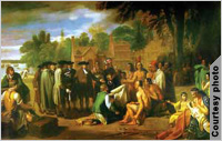
(Penn. Acad. of Fine Arts)
後にアメリカ合衆国となる土地を、ヨーロッパ人が最初に発見したとき、そこに住んでいたのはおそらく80万人ほどの原住民で、小さな部族単位で生活を営んでいた。
アメリカン・インディアン諸族の文化には大きな多様性があった。現在のカリフォルニア州沿岸だけでも数百種類もの方言が話されていた。現在のニューメキシコ州に住み南のアステカ族から文化的な影響を恐らく受けていたプエブロ族は定住生活を送り、大規模な灌漑システムを作り上げていた。「グレートベースン」(Great Basin=西部の大盆地)のパイユート族は草ぶき屋根の小屋に住み、野生の食用植物や小型の野生動物を食べて半遊牧民の生活を送っていた。イヌイット族つまりエスキモーは、ヨーロッパ人がアメリカ大陸にやってくる前に出現した民族の中で最も新しく、グリーンランドやシベリアのイヌイット族と密接な文化的つながりを持っていた。
アメリカン・インディアンはヨーロッパ人の入植地の拡大を妨害することもあったが、多くの場合彼らの影響はごくわずかであった。ヨーロッパ人との直接接触を経験する前に、天然痘やはしかのような外から持ち込まれた感染症で多くは死んでしまったからだ。特に入植が始まった最初の数十年間はインディアンはヨーロッパ人たちに多大な貢献をしたが、ほとんどの場合殺されるか、西部の特別居留地に追いやられることとなった。入植地の辺境が西へ向かうにしたがい、アメリカン・インディアンとその特別居留地もまた西へ移っていった。
ヨーロッパからそして数は少ないがアフリカからどれだけの数の人々が現在の米国に移住したのかを正確に述べるのは不可能だが、6,000万人近いとみるのが妥当な推計だろう。
最初にやってきたのは北西ヨーロッパからの移住者だった。1790年に米国で最初の国勢調査を実施したとき白人人口の3分の2以上はイギリス出身であり、次に多かったのはドイツとオランダだった。
北米への移住の流れは、1760年から1815年にかけて速度が鈍った。この時期ヨーロッパと北米で、また大西洋で断続的に戦争が起きていたからである。1815年ごろから1914年に第一次世界大戦が始まるまでの間、北米への移住は10年ごとに増加していった。
この1815-1913年という期間のうち最初のおよそ50年間は、相変わらずほとんどの移民が北西ヨーロッパ出身だった。その後の数十年間は南欧および東欧からの移民が流れ込んだ。1913年までには全体の優に5分の4以上が南欧および東欧からの移民で、特にイタリア、オーストリア・ハンガリー、ロシアが多かった。
このように移民の傾向が変化したのは産業革命の影響によるものである。18世紀にイギリス諸島と北海沿岸低地帯(現在のベルギー、オランダ、ルクセンブルク)で始まった産業革命はその後150年ほどかけて南東方向へ広がった。工業化とともに死亡率が下がり人口が急増した。経済活動は製造業に移行し、都市化が進み、それに比例して農業人口が減少した。都市労働に対する需要の伸びは、潜在的な労働力人口の増加ほど高くなかった。かくして多くの移民が進んで米国へ押しかけることになった。
ヨーロッパから米国への移民達は故郷と似た環境にある地域を選んで住み着いたのではないか、としきりに言われてきた。典型例としてミネソタ州、サウスダコタ州、ノースダコタ州にかなりの数のスカンジナビア人が入植したことが挙げられる。この説には多少の真実が含まれているかもしれないが、スカンジナビアから多くの人々が移住してきた時期には、辺境の入植地の大半がこれらの州であった、ということの方がより重要な意味を持っている。米国の民族的な定住分布図のモザイクは、ほとんどの場合、人々が機会を求めて移動した結果である。そうした機会が最初に見つかったのはほとんどは辺境の農業入植地であり、その後都市に移って行ったのである。
移民入植地パターンの注目すべき例外は、米国南部における黒人の入植地である。アフリカ人たちは南部の大農場で働く奴隷労働力として強制的に連れてこられたのだが、これはカリブ海地域や南米の北東部沿岸、そして米国の南東部へのアフリカ人の大移動のほんの一部であった。この大移動は人類の歴史の中で恐らくヨーロッパから米国への大脱出に次ぐ2番目の規模の長距離移動だったと思われる。およそ2,000万人がアフリカを離れたが米国へ渡った黒人は推定50万人未満だった。その多くはアフリカから直接ではなく、もしかしたらカリブ海地域経由でやってきたのかもしれない。1790年の国勢調査によると、この時点での米国人口の20%はアフリカ系だ。この年以降アフリカ人の入植はほとんどなく黒人人口の比率は減少した。たとえば
米国が移民を制限する最初の重要な法律を成立させたのは1920年代だった。この制限と1930年代の大恐慌、そして1940年代の第二次世界大戦が相まって、年間の移民数は1913年をピークに大幅に減少した。1945年以降移民数はある程度増加した。1960年代にはそれまでよりはるかに寛大な移民法が成立した。1980年代後半にはメキシコ、フィリピン、西インド諸島からの移民が最も多くなった。現在、米国が1年間に受け入れる合法的移民の数は通常70万人ほどである。不法入国者も毎年27万5,000人ほどに達する。
初期の入植者達は規模が小さく、大西洋にしがみつき、周りの土地よりも海の向こうのヨーロッパに目を向けていた。試しに海から離れ内陸部に定住しようという場合でも、依然として入植地は河川に沿って形成された。河川が沿岸部に至る通商経路となりヨーロッパとの重要なきずなを提供したのである。かくしてイギリス人は入り組んだチェサピーク湾岸とその支流域に入植し、そこからニューイングランドの険しい沿岸線に沿って細い帯状に開拓地を広げていった。オランダ人はニューアムステルダム(ニューヨーク)からハドソン川を上った。フランス人はセントローレンス川上流の岸辺に徐々に定住していった。
ヨーロッパ人が北米への永久移住を始めてから150年間-1765年ごろまで-は、西への移動もアパラチア山脈の東側までがやっとであった。その後100年間のうちに辺境は太平洋に到達し、1890年までには米国国勢調査局が入植すべき米国の辺境地域は消滅したと宣言できるまでに至った。
このように開拓地が急速に拡大し続けた理由は、移民たちがヨーロッパへのこだわりを捨てたことにあった。19世紀の初頭までに、この大陸を占有することが自分たちの「マニフェスト・デスティニー(明白な天命)」だと考える米国人がますます増えていた。米国の土地関連法はどんどん拡張主義に傾いていった。そしてまた人口増加に伴い、西へ移動して一旗上げたいと考える人々も増えていった。
カンザス州やネブラスカ州あたりまでの米国の東半分では西方への開拓は概して秩序正しく進んだ。もちろんオハイオ川などの特定の輸送ルート沿いでは開拓ペースが速く、そのほかの場所では遅かった。
入植は西に向かって急速に進み内陸の草原地帯に入った。ミシシッピ川とその多数の支流が内陸部への容易なルートを提供した。開拓者たちの目の前には概ね作物の生産に適した気候の広大な素晴らしい農地が、アパラチア山脈の西端からグレートプレーンズの奥の方まで広がっていた。
しかしロッキー山脈の西側とアラスカ州では、入植地の拡大パターンが均等にならなかった。この広大な土地の多くは余りにも乾燥しているか、暑すぎるかもしくは寒すぎるかのいずれかで農業には適していなかった。険しい地形が輸送を阻み農業の発達をさらに制限した。入植地は経済的な力を見出せる土地に集中した。その結果ほとんど人の住んでいない土地の中に開拓地が点在するというパターンになった。
2000年の米国の人口は2億8,000万人を超え1平方キロメートルあたりの人口密度は約265人となった。主な人口密集地帯は3つ挙げられる。まず筆頭は「一次地帯」で、ボストン(マサチューセッツ州)、シカゴ(イリノイ州)、セントルイス(ミズーリ州)、そして首都ワシントンD.C.を結んでできる四辺形に入る地域である。米国で最も人口が多い12州のうち7州がこの地域に含まれている。ここは最も早くから発展し長きにわたって米国で最も経済的に進んだ地域である。素晴らしい天然の水路と大西洋に沿って多数存在する良港を網の目のような交通路線が支えている。国内有数の農地と豊かな鉱物資源が、この地域内かもしくは近辺に存在する。
「一次地帯」の南端および西端を囲み、そこから西へグレートプレーンズの東側に向かって伸びているのが人口密集の「二次地帯」である。米国で最も肥沃な農地のほとんどがこの地域内にあり、農地としての潜在力を持つ土地の大部分が耕作されている。この地域の大半には人が居住しているが、概して一般的に人口密度は「一次地帯」よりはるかに低い。一次地帯よりも都市はより均一に分布し都市間の距離も遠い。そして都市は主にこの地域のサービス業・製造業の中心となっている。
最後は「周辺人口地帯」で、これがグレートプレーンズの中央部から西方に広がっている。本来は成長性が限られた地域なのに特別な潜在能力を持つ区域だけは人口が増加し、経済が成長するというパターンが相変わらず続いている。カリフォルニア州のサンフランシスコ湾岸地域やロサンゼルス盆地、ワシントン州のピュージェット湾低地のように今では人口密度が高いところもあるが、地域全体としてはほとんどは人口がまばらなままである。
米国における人口移動の歴史は3つの時期に分けることができる。まず東部から西部への移動の期間があり、次に田舎から都市部への移動が多くみられた時期、そして最後が長距離移動の大部分が大都市間である現在である。かりに米国の人口が着実に西へ移動していったとすれば、それと同じペースで都市化も進んでいったことになる。1790年には幅広く定義すれば都市居住者であるといえた人は全人口の10%に満たなかったが、1990年には4分の3以上が都市居住者であった。
こうした統計は田舎の人口が相対的に減少したことだけでなく、農業人口が絶対的に減少したことを示している。例えば1960年から1987年までの間に、農業人口は1,500万人超から600万人未満に減少した。
米国の人口が東部から西部へまた田舎から都市へ移動したのは、いずれも経済的機会がそこにあると認識したためであることは明らかだ。まず入植地の辺境が西へ向かうにつれて、所有できる農地が次から次へと増えていった。次に産業革命により、都市で途方もないほど雇用が激増した。いったん米国人の大部分が都市居住者となり経済的機会も都市が中心になると、その経済的機会も多様になり、その後の人口移動はほとんどが大都市間の移動となった。
1970年代および80年代の米国の人口統計は、第4の重要な人口移動時期が目前に迫っていることを示唆している。長年にわたり人口がまったく変動せず、あるいは減少さえしていた地域が、今では成長しているのである。南部の多くがその好例である。
多くの識者が米国は脱工業化社会になったことを示唆している。つまりサービスを提供したり情報の操作・作成を行ったりする仕事が、主要な成長分野であるというわけだ。製造業に雇用される米国人の数は過去20年間にわずかしか増加しなかったが、第三次産業および第四次産業での雇用は急速に増大した。製造業での雇用増加分の多くは、電子部品のように付加価値の高い軽量な製品の製造に関連するものだった。この種の製造業は恐らくどこにでも立地できる。こうして住みたい場所に住むことができる人々がますます増えている。
米国には、いたるところに人口と面積が成長を続けてきた都市部が存在する。少数ではあるが、あまりにも成長が大きく各中核都市の規模が拡大しすぎたため、主要な都市部が合体して連結都市ともいうべき大都市グループを作り出した例もある。北東部の海岸線にそってボストン(マサチューセッツ州)からワシントンD.C.に至る大都市グループが、最も明白な例である。もっと広い範囲に分散し中心都市の規模も小さいが、もう1つの都市部グループの例としては五大湖の南側にある都市群を挙げることができる。ミルウォーキー(ウィスコンシン州)とシカゴ(イリノイ州)がこの地域の西部の要であり、バッファロー(ニューヨーク州)とピッツバーグ(ペンシルベニア州)が東部の要である。識者によってはサンディエゴからサンフランシスコに至る南カリフォルニアも、フロリダ州の東部沿岸部と中央部の大部分と同様に、いずれは都市部が合体すると予測する人もいる。
ほとんどの大きな都市部は、交通路で互いにつながっている場合に発展してきた。多くの場合、重要なのは陸路と水路の接続である。都市部の中心は海岸や河口域に位置する場合もあり、航行可能な天然水路の近くに位置する場合もある。また都市に水路を提供するためだけに大幅に改修された河川や運河に沿って位置する場合もある。もちろんこのほかの要素も重要である。後背地の性質や代替交通手段への近さ、治安、さらには地域環境の健康への影響などである。しかしモノや人がある輸送手段から別の形の輸送手段へ乗り換えなければならない場合には、製品を加工し、交換し、製造し、再包装し、売買する機会が存在する。
海岸や河口域が好まれたのは事実だが例外もある。例えばアトランタ(ジョージア州)、デンバー(コロラド州)、ダラス・フォートワース(テキサス州)などである。だが、これらの都市もまた何らかの初期の輸送ルート沿いにあった。例えばアパラチア山脈の南端に位置するアトランタは、1860年代までに南部での鉄道輸送の内陸にある中心地の1つになっていた。
米国の最大の強さの1つは、共通の言語により地理的にも社会的にも統合された面積も人口も世界最大の国だという点にあると言う人がいる。しかし本稿で論じる地域の多くは、少なくとも何らかの形で文化的な個性を持つ地域である。
地域的な文化の違いは多彩な形で表現される。インディアナ、ケンタッキー、オハイオ、イリノイの各州は、人口比で見た場合、全米平均を大幅に上回る数のトップクラスの大学バスケットボール選手を輩出している。初期のカントリー・ミュージック歌手の圧倒的多数は南部の内陸部出身だった。
各地域の特徴は自然環境と文化的影響が混じり合って生まれる。19世紀に米国で広く用いられた土地測量法のおかげで、中西部の多くではひと目で分かる格子状の長方形の土地区画が特色となった。ペンシルベニア南東部のドイツ系およびイギリス系農民は、建物の片側の2階に1階からせり出した増築部分をつけた家畜と干草を貯蔵する大きな納屋を建てた。民俗建築学の研究者の間ではその起源について一部に異論があるかもしれないが、この「ペンシルベニア・バーン(納屋)」が同州の文化圏を特定する重要な要素の1つであることは多くの人が認めている。多くの都市では地元の小さな店やレストランの名前を見るだけで、そこがどの民族地域かを知ることができる。
文化の多くの側面は保守的で頑固だが、にもかかわらず変化は米国文化の一貫した側面であることに変わりはない。そうした変容の多くは技術的、経済的条件の変化から生じる。人の移動もまた重要な要素の一つである。
米国文化の個々の要素のうち最も興味深く影響力の強いものの1つが宗教である。ヨーロッパからの移民によって、数々の大きなキリスト教会が米国に持ち込まれた。これらの教会の分布は、それぞれの移民グループやその子孫が人口の大部分を占める地域と密接に重なっている。例えばドイツ系とスカンジナビア系の移民は、ルーテル教会を「グレートプレーンズ」北部および「農業中枢(Agricultural Core)」の北西部にもたらした。南西部のヒスパニック系や北東部、中西部と、それに南部以外のほとんどの大都市に住む南欧および東欧からの移民、そしてルイジアナ州南部に移住したフランス系アカディア人などの存在は、米国国内でローマ・カトリック教が広い範囲に分布している理由を物語っている。
米国ではまた新しい会派が活発に生まれた。米国聖公会(かつては英国国教会の一部)などの諸会派は1700年代後半の米国独立戦争の終結時に生まれた。米国の長老派教会は南北戦争後の分裂の結果としていくつかの会派に別れた。
新しい会派が生まれたもう1つの理由は、米国人の宗教的な創造力である。聖書の解釈や教会の運営などの問題をめぐる見解の相違が原因で個人が自分の教会を設立したり、あるいは信徒や信徒グループが会派を離れ別の新しい会派を作ったりしてきた。
米国生まれの会派の1つに、一般にはモルモン教会として知られる「末日聖徒イエスキリスト教会」がある。19世紀半ばにニューヨーク州北部で生まれたこの会派は、信徒が定住し教義に従って生活できる孤立した場所を求める信徒によって次第に西の方へ移動していった。彼らは最終的にユタ州を選んだ。今日では、ユタ州住民の多くがモルモン教徒である。
南部バプティスト派は、上記の会派誕生の理由がいくつか重なった興味深い事例である。バプティスト派は自由な礼拝を目指す非公式の教会として、初期のヨーロッパ人移民によって米国に持ち込まれた。19世紀の最後の30年余りの間にこの会派はほとんど南部文化の宗教的発露も同然であり、この地域で最も有力な教会となった。あるコミュニティが文化的に南部の一部であるかどうかを測る尺度は、そのコミュニティに少なくとも1つの南部バプティスト教会があるかどうかだといっても過言ではない。
*上記の日本語文書は参考のための仮翻訳で、正文は英文です。
Foundations of Human Activity
(The following article is taken from the U.S. Department of State publication, An Outline of American Geography.)
Foundations of Human Activity
By Stephen S. Birdsall and John Florin
The country that came to be the United States had a small, dispersed native population at the time of initial European discovery, totaling perhaps 800,000 people, most organized in small tribal units.
There was great diversity among American Indian cultures. Several hundred dialects were spoken along the coast of California alone. The Pueblo, who lived in what is now New Mexico and who were probably influenced culturally by the Aztecs to the south, resided in permanent towns and constructed extensive irrigation systems. The Piutes of the Great Basin lived in temporary thatch dwellings and pursued a seminomadic existence based on available wild edible vegetation and small game. The Inuit, or Eskimos, who were the most recent of the pre-European arrivals, shared close cultural ties with Inuits in Greenland and Siberia.
Although American Indians represented a barrier to the expansion of European settlement at times, for the most part their impact was minimal. Many died of imported infectious diseases such as smallpox and measles before they experienced direct contact with the Europeans. The Indians made important contributions to the arriving Europeans, especially during the first decades of settlement. But most often they were killed or shunted off to reservations in the West. As the settlement frontier moved westward, so did the American Indians and their reservations.
SETTLEMENT PATTERNS
Although it is impossible to state precisely how many people entered what is now the United States from Europe and, to a lesser extent, from Africa, a reasonable estimate would place the figure at close to 60 million.
Most early immigrants came from northwestern Europe. At the time of the first national census of the United States in 1790, more than two-thirds of the white population was of British origin, with Germans and Dutch next in importance.
Emigration to North America slowed between 1760 and 1815. This was a time of intermittent warfare in Europe and North America, as well as on the Atlantic Ocean. Between about 1815 and the start of World War I in 1914, immigration tended to increase with each passing decade.
For the first half of the 1815-1913 period, most migrants continued to come from northwestern Europe. They were followed in subsequent decades by streams of people from southern and eastern Europe. By 1913, well over four-fifths of all immigrants were from these areas of Europe, especially Italy, Austria-Hungary, and Russia.
The reasons for this shift are based on the impact of the Industrial Revolution. Beginning in the British Isles and the Low Countries in the 18th century, it spread southeastward during the following 150 years or so. With industrialization came a rapid rise in population as mortality declined. The economy shifted to manufacturing, urbanization increased, and there was a proportional decline in the agricultural population. The growth in the demand for urban labor did not match the increase in the potential labor force, and thus there were many willing emigrants.
It has been suggested repeatedly that migrants to the United States chose areas that were environmentally similar to their European homes. The substantial Scandinavian settlement in Minnesota and the Dakotas is indicated as a case in point. There may be some small truth in this, but it was more important that those states represented the principal settlement frontier at the time of major Scandinavian immigration. For the most part, the mosaic of ethnic patterns in America is the result of a movement toward opportunity – opportunity first found most often on the agricultural settlement frontier and then in the cities.
The major exception to the immigrant settlement pattern was black settlement in the American South. Forced to move as slave labor for the region's plantations, this was a small part of the large movement of Africans to the Caribbean Basin, the northeast coast of South America, and the American Southeast. Next to the European exodus, this was probably the second largest long-distance movement in human history. Perhaps 20 million left Africa. It is believed that fewer than 500,000 blacks came into the United States. Most probably arrived from the Caribbean rather than coming directly from Africa. The 1790 census indicated that 20 percent of the American population was of African origin. There was little African immigration after that date, and the percentage of the population that was black declined.
The United States passed its first major legislation to restrict immigration in the 1920s. This limitation, coupled with the Great Depression of the 1930s and World War II in the 1940s, cut immigration to a fraction of its annual high in 1913. Since 1945, the number of arrivals has increased somewhat. Far more liberal immigration laws were passed in the 1960s. In the late 1980s, Mexico, the Philippines, and the West Indies provided the greatest number of migrants to the United States. Today, the United States typically receives roughly 700,000 legal immigrants annually. About 275,000 illegal aliens also enter the country each year.
The first immigrant settlements were small, clinging to the ocean and looking more toward Europe than toward the land that crowded in about them. When settlement pushed tentatively away from the oceans, it still followed the waterways, for they offered trade pathways to the coast and an important link to Europe. Thus, the British settled the indented coastline of the Chesapeake Bay and its tributaries, and they spread a thin band of settlement along the rugged coastline of New England. The Dutch moved up the Hudson River from New Amsterdam (New York), and the French gradually settled the banks of the upper St. Lawrence River.
During the first 150 years after the beginnings of permanent European settlement – until about 1765 – Europeans moved westward only as far as the eastern flanks of the Appalachian Mountains. Within a century after that, the frontier reached the Pacific Ocean, and by 1890, the U.S. Bureau of the Census was able to announce that the American settlement frontier was gone entirely.
This increasingly rapid settlement expansion resulted from a reorientation in attitude away from Europe. By the early 19th century, an increasing number of Americans viewed the occupation of the continent as their manifest destiny. The land laws of the country became increasingly pro-expansionist. Also, as the population grew, there were more people who hoped to improve their lot by moving westward.
In the eastern half of the United States, about as far west as Kansas and Nebraska, settlement expanded westward in a generally orderly fashion. To be sure, advances were more rapid along certain transportation routes, such as the Ohio River, and slower in other places.
Settlement moved rapidly westward onto the interior grasslands. The Mississippi River and its many tributaries offered easy routes to the interior, and settlers found an expanse of excellent agricultural land with a generally good climate for crop production that stretched from the western margins of the Appalachians well into the Great Plains.
From the Rocky Mountains westward and in Alaska, however, an even pattern of settlement expansion did not occur. Much of this broad area was either too dry, too hot, or too cold for farming. Rugged topography hampered transportation and further limited agricultural development. Settlement congregated in areas that offered an identifiable economic potential. The result was a pattern of point settlement scattered across an otherwise nearly unpopulated landscape.
In 1990, the United States had a population approaching 250 million, with a density of roughly 235 people per square kilometer. Three principal zones of population can be identified. First, a primary zone fills a quadrant defined approximately by the cities of Boston (Massachusetts), Chicago (Illinois), St. Louis (Missouri), and Washington, D.C.: 7 of the 12 most populous U.S. states are here. It is the area of earliest growth and long the country's most advanced section economically. Fine natural routes and many excellent harbors along the Atlantic shore have been augmented by a dense transportation net. Some of the country's best agricultural lands plus rich mineral resources are either within the region or nearby.
Wrapping around the southern and western margins of the primary zone and extending westward to the eastern sections of the Great Plains, there is a secondary zone of population. Much of America's best agricultural land is in this zone, and the greatest part of its potential agricultural lands are farmed. Most of the area is populated, although densities are generally much lower than those found in the core. Cities are spaced more widely and more evenly in this zone than in the core, and they are primarily service and manufacturing centers for the region.
Finally, a peripheral population zone fills the land from the central Great Plains westward. A pattern of population and economic growth at locations of special potential in an otherwise limited region continues to dominate. Although some areas are now densely populated – notably California's San Francisco Bay area and Los Angeles Basin, as well as the Puget Sound Lowland in Washington State – most of the land remains sparsely populated.
The mobility history of the United States can be divided into three periods. First came the period of east to west movement, then one from rural to urban areas, and, finally, the present period, when most long-distance movement is between metropolitan areas. If the country's population has moved westward with every decade, it has urbanized in an equally unvarying fashion. Whereas less than 10 percent of the population could even loosely be defined as urban in 1790, over three-quarters was urbanized by 1990.
These statistics reflect not only a relative decline in rural population, but also an absolute decline in farm population. Between 1960 and 1987, for example, the farm population fell from more than 15 million to under 6 million.
The movements from east to west and from rural to urban America were both clearly in response to the perception of economic opportunity. First, more and more farmlands became available as the settlement frontier pushed westward. Then there was a tremendous surge in urban employment generated by the Industrial Revolution. Once Americans were predominantly urbanites and economic opportunities were also urban based, variations in these opportunities ensured that most subsequent population migration would occur between metropolitan areas.
U.S. population statistics for the 1970s and 1980s suggest that a fourth major mobility period is at hand. Areas that had long experienced no change or even declining population size are growing. Much of the South is a prime example.
Many observers have suggested that the United States has become a post-industrial country. That is, the major growth areas are in occupations that provide services and that manipulate and create information. The number of Americans employed in manufacturing has increased only slightly during the past two decades, whereas tertiary and quaternary employment has boomed. Much of what increase there has been in manufacturing employment has been in the production of high-value, lightweight products, such as electronic components, which can presumably be located almost anywhere. Thus, more and more people can live where they want.
URBANIZATION
Most of America possesses urban areas that have grown in population and extent. In a few instances, the growth has been so great and the size of the core cities has become so large that major urban areas have merged and formed clusters of cities. The group of large cities extending from Boston (Massachusetts) to Washington, D.C., along the northeastern U.S. coast, is the clearest example. Another group of urban areas – more widely dispersed and containing smaller central cities – is found along the southern margin of the Great Lakes. Milwaukee (Wisconsin) and Chicago (Illinois) anchor this region in the west, and Buffalo (New York) and Pittsburgh (Pennsylvania) do the same in the east. Southern California, from San Diego to San Francisco, is offered by some observers as yet another set of urban areas that will be merged by the end of the 20th century, as is much of east coastal and central Florida.
Most large urban places have developed where transportation routes connect with each other. Quite often it is the land-water connection that is important. Some urban centers are on a seacoast or large estuary. Others are on naturally navigable waterways. Still others are on rivers or channels that have been modified extensively just to give the cities water access. Other factors matter, of course: hinterland quality, proximity to alternative transportation, security, and even healthfulness of the local environment. However, where goods and people must transfer from one form of transportation to another, there are opportunities to process, exchange, manufacture, repackage, sell, and buy goods.
There are exceptions to this water orientation, such as Atlanta (Georgia), Denver (Colorado), and Dallas-Ft.Worth (Texas), but these, too, were on early transport routes of some kind. Atlanta, for example, located at the southern tip of the Appalachian Mountains, had become a key inland center for railroad transportation in the South by the 1860s.
PATTERNS OF REGIONAL CULTURE
Some argue that one of the great strengths of the United States is that it is the world's largest and most populous country joined geographically and socially by a common language. Nevertheless, most of the regions identified in this text are at least in part culture regions.
Regional variation in culture may be expressed in many different ways. Indiana, Kentucky, Ohio, and Illinois produce far more big-time college basketball players per capita than the national average. The vast majority of early country music singers were from the upper South.
The landscape of an area is a blending of the natural environment and a cultural imprint. The land survey system used widely in the United States during the 19th century created a striking grid rectangularity to the landscape of much of the Middle West. The German and English farmers of southeastern Pennsylvania built large cattle and hay storage barns with a second story extension over the first on one side. While students of folk architecture may argue its origins, most agree that this "Pennsylvania barn" is a key identifying element in the landscape of the state's culture area. Ethnic areas in many cities can be located simply by looking at the names on small neighborhood stores and restaurants.
While many aspects of culture are conservative and consistent, change is nevertheless a constant part of American culture. Many of the alterations result from changes in technology and economic conditions. Migration is another key ingredient.
Of the individual elements of American culture, one of the most interesting and telling is religion. A number of the larger Christian churches were brought to America by European migrants. The distribution of these denominations closely matches the areas where those migrant groups and their descendants form a large part of the population. For example, German and Scandinavian settlers carried their Lutheran church to the northern Great Plains and the northwest portion of the Agricultural Core. Hispanics in the Southwest, southern and eastern Europeans in the Northeast, the Middle West, and most large cities outside the South, and French Acadians who migrated to southern Louisiana – all help explain the widespread distribution of Roman Catholicism in America.
The United States has also been a place of active denominational creation. Several denominations, such as the Episcopalians (formerly part of the English Anglican church), were created at the end of the American Revolution in the late 1700s. Presbyterianism in the United States is divided into several denominations as a result of a post-Civil War split.
Another explanation has been the creativity of American religion. Individuals established their own churches – or congregations or groups of congregations left a denomination to form a new one – because of disagreements over such questions as biblical interpretation or church administration.
One native American church is the Church of Jesus Christ of Latter-Day Saints, commonly known as the Mormon church. Founded in upstate New York in the mid-19th century, it was gradually carried westward by its followers in search of an isolated place to settle and follow their beliefs. They eventually chose Utah. Today, most residents of Utah are Mormons.
Southern Baptists are an interesting joining of several of the above explanations. Baptism was brought to America by early European migrants as a non-established church seeking freedom of worship. During the last third of the 19th century, it was almost the religious expression of Southern culture and became the dominant regional church. One measure of whether a community is culturally part of the South surely must be the existence in it of at least one Southern Baptist church.
[Stephen S. Birdsall is dean of the College of Arts and Sciences at the University of North Carolina at Chapel Hill. He holds a master's and a doctoral degree in geography from Michigan State University and is the co-author of four books and atlases, including Regional Landscapes of the United States and Canada.]
[John Florin is chair of the geography department at the University of North Carolina at Chapel Hill. He holds a master's and a doctoral degree in geography from Pennsylvania State University. His recent publications include Atlas of American Agriculture: The American Cornucopia with Richard Pillsbury and Regional Landscapes of the United States and Canada with Stephen S. Birdsall.]